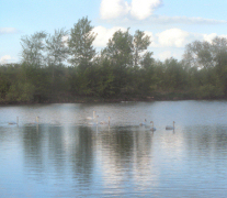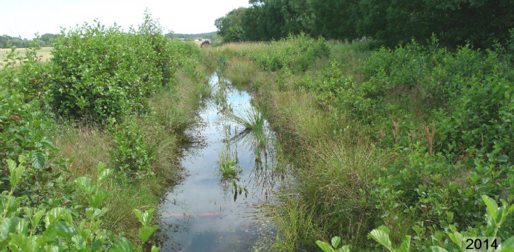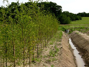
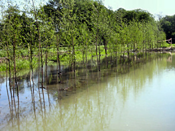
Photos: Integrated Buffer Zone
before and during
flooding.
|
Drainage of agricultural land is often a prerequisite
for food production in countries with humid climate. Drainage pipes
however, creates a direct and rapid contact between arable fields and
recipient and act as underground highways for water and nutrients.
Current drainage losses account for up to 60% of the total nitrogen
losses and about 30% of the phosphorus losses in regions with intensive
agriculture.
Leakage of nutrients from agricultural land
through drainage is one of the major problems in the Baltic Sea drainage
basin, with major negative impacts on the marine environment. To ensure
the good ecological status of the Baltic Sea and in our water courses we
need new innovative methods.
By use of the Integrated Riparian
takes a holistic approach to the land-water-nutrient-cycle in our
production system and breaks the one-way transport of nutrients from the
catchment to the sea. Instead we get a more closed system with
retention, immobilization and re-cycling of nutrients and the
attenuation of flood peaks.
The design allows farmers to benefit
directly from ecosystem services such as nutrient re-circulation,
controlled drainage and biomass production.
The concept is
area-efficient and involves only minor intrusion on productive
agricultural land. Integrated protection zones are thus multifunctional
and lead to "win-win" situations for farmers and agricultural production
systems while reducing the nutrient transport to the Baltic Sea and
increases the chances of achieving several of the Swedish environmental
objectives and the EU's Water Directive. |
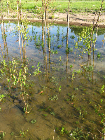
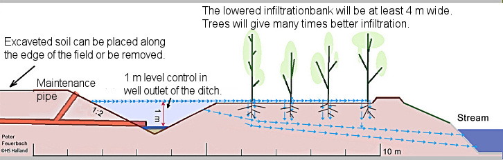
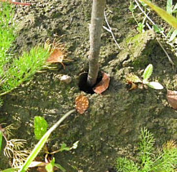
Trees affect the infiltration characteristics of soils in several
ways: Leaves dragged down by worms causing large holes. After a while,
when more and more leaves have accumulated on the surface the
infiltration bank is protected even against hard rain effects, which out
on the naked field can quickly close all open soil pores.
The
wind creates mechanical vibrations and also moves the trunk so that
openings in the soil around the trunk develop. Along the finer roots, a
thin water-film forms that can distribute the water further. During
summer a lot of water is absorbed by vegetation and evaporates into the
air.
 |
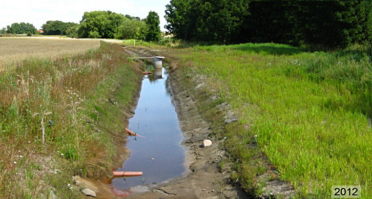
Function of the IBZ
The integrated buffer zones are placed like the traditional protection zones
along watercourses. The width is 10 m, but may vary, and about 70-100 m
long, depending on the topography. The integrated buffer zones consist
of two segments, a water-filled collecting ditch and a infiltration
bank.
Parallel to the watercourse a ditch is excavated that cut
the drain pipes that normally discharges into the watercourse. On the
other half of the integrated protection zone, closest the river, the
ground level is lowered by removing about 10-15 cm of topsoil and spread
out on the field, so that an infiltration bank formed. The excavation is
done so that the infiltration bank is completely flat and horizontal.
The closed collection ditch is about 4 m wide at the crest and the
infiltration bank at least 4 meters wide. However, it can be designed
considerably wider and have irregular shape, subject to availability of
suitable land.
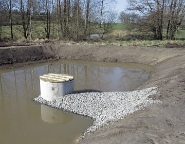
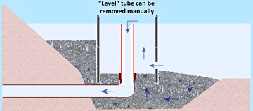
A control well (of the model “Halland level well")
is placed in the ditch, with an outlet to the water course at a level
about 10 cm above the level of the infiltration bank. The outlet level
can if necessary be lowered all the way down to the bottom of the ditch.
When it rains and the water starts to flow in drain pipes, the water
level in the ditch raises up to cover the infiltration bank. This can be
an advantage in summer when the water can be saved by the increase of
the water table. At even more rain, when the infiltration bank is not
able to receive extreme amounts of water, surplus water is evacuated
just above the level of infiltration directly into the watercourse.
When it is instead the other way around, and fields should be as dry
as possible, for example, when they should be plowed or harvested, the
water level can be temporarily very easily and quickly lowered by
lowering the water level in the outlet well to a level near the ditch
bottom. On the infiltration bank trees are planted (or allowed to
established naturally) because this increases the infiltration capacity
many times (up to 60 times). After 10-15 years the biomass can be
harvested, and the sediments in the trench excavated. Nutrients are not
only barred from reaching the watercourse but they are also
re-circulated in a smart and sustainable way.
Level control with the "Halland
level well"
The insert pipe can be easily lifted out if no seal rings are used.
 |